

ATLANTIC & PACIFIC HURRICANE ACTIVITY & PREDICTIONS 2014

August 03 at
1544 EDT
(0944 PDT)

July 23 at
2039 EDT
(1439 PDT)

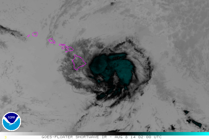
Iselle about to set a record becoming the first cyclone to hit the Big Island

August 04 at 0800 PDT (1500 UTC) Iselle reaches Category 4 Hurricane status
Personal Insights
Observations
Hurricane Iselle - the Big Bug of the Big Island
August 08 at 0200 UTC shortwave infrared satellite imagery GOES floater/NOAA
The best and worst of what Iselle had to offer
July 23 was a date given to me to be on the lookout for the next wave of activity set to play out in the high seas. Several areas will be popping up with potential for cyclone formation during this phase of the tropical cyclone season. First I was shown that four storms will come out of all the activity to take place in the coming weeks and then I was shown (image above) that out of these four three strong one will come one following after the other. This phase or cycle will all come to an end by August 16, another date given to me. The four cyclones that formed between July 23 and August 16 were Genevieve, Hernan, Iselle and Julio. Of these four Hernan became a Category 1 Hurricane whereas the other three all became Major Hurricanes.
On July 29 I had a dream in which I saw two parallel rectangular areas. From this I deduced that two more cyclones will be forming one shortly after the other and one trailing behind the other. On July 31 Iselle forms followed by Tropical Depression 10-E (later called Julio) on August 03. Iselle makes a bee-line towards the Hawaiian islands aiming right for the Big Island and though Julio is on its heel I don't sense that he will be passing over the islands along with Iselle. In fact, three storms end up traversing in the vicinity of the islands, the third being Genevieve, but only Iselle cuts across the territory. I also sensed that there is nothing really to worry about in terms of fatalites and widespread damage. Yes Hurricane Iselle will come for a visit but should be downgraded by the time she makes it ashore.
In the early morning hours of August 4 Iselle becomes a Major Category 4 Hurricane with sustained winds of 140 mph, 220 km/h. NOAA keeps posting advisories showing that Iselle is making a direct path towards the Big Island. Even though NOAA keeps showing that Iselle should be a storm by the time it makes landfall, with every new advisory Iselle keeps showing up as a hurricane. That's enough to get everyone prepared for the worst.
With Iselle maintaining strength even the weather experts are conceding the fact that she may be a hurricane as she approaches the coastline. But with just hours to go before making landfall Iselle is downgraded to a tropical storm with winds about 60 mph, 100 km/h as she makes it ashore. By the time Iselle passes south of Kauai, 24 hours later, she has winds of only 40 mph, 65 km/h. A sigh of relief for everyone.
Iselle brought about strong waves to the coastal areas of the islands as well as causing damage to plants and trees and manmade structures.