

ATLANTIC & PACIFIC HURRICANE ACTIVITY & PREDICTIONS 2014
August 04 at
2000 PDT
(1700 HST)
(2300 EDT)
August 03 dream of two strong areas

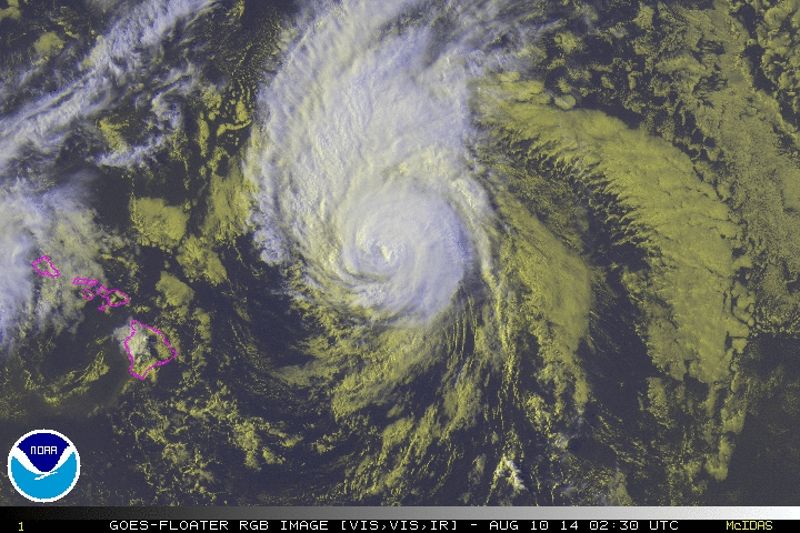
On August 10 Julio is seen passing north of the Big Island

August 07 at 2000 PDT
(0300 UTC)Julio reaches Category 3 Hurricane status
Personal Insights
Observations
Hurricane Julio - part of the one-two punch that never was
August 10 at 0230 UTC RGB satellite imagery GOES floater/NOAA
The best and worst of what Julio had to offer
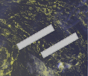
On July 29 I had a dream in which I was shown two rectangular areas parallel to one another. From this I concluded that two storms will be emerging soon and one to follow shortly after the other. It is quiet in the North Atlantic so realize that this must be referring to the formation of two cyclones in the eastern North Pacific basin, namely, Iselle and Julio. Tropical Storm Iselle forms on July 31. Then on August 03 I get a similar dream and note that the rectangular objects are metallic in appearance thus indicating that these cyclones will be strong systems.
On August 04 Iselle becomes a Category 4 Major Hurricane with winds of 140 mph and is followed by Julio becoming a Major Category 3 Hurricane on August 07 with winds of 120 mph.
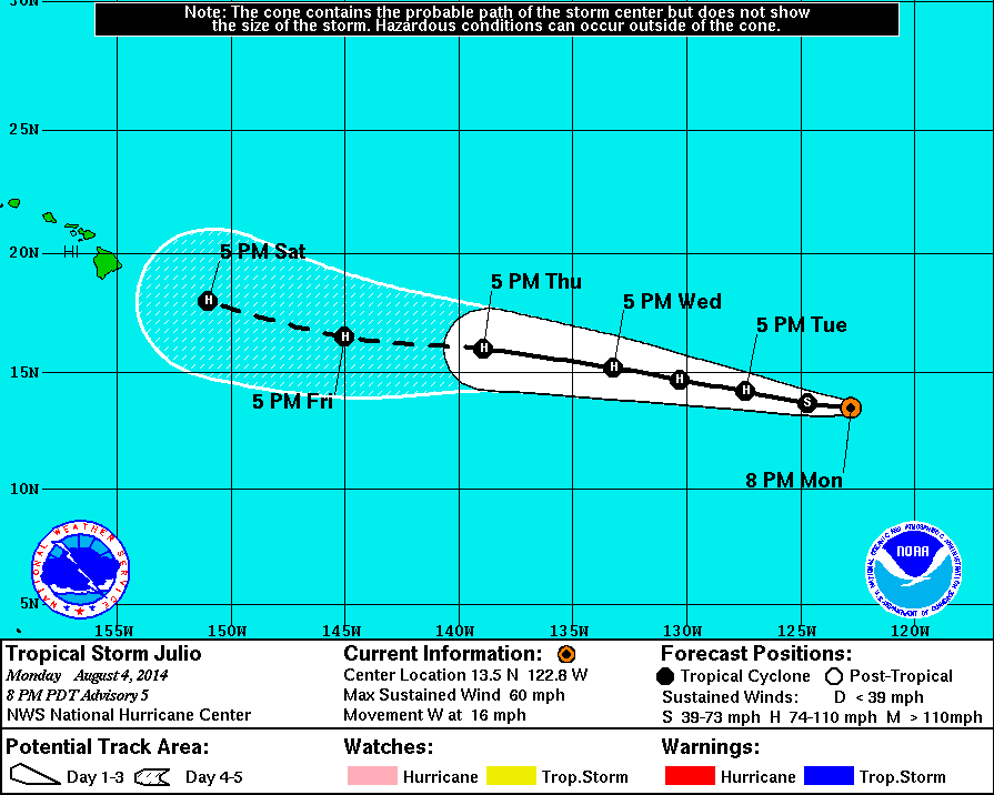
If you were in Hawaii on August 4th and on the news at 5 pm saw this graph displayed you'd be concerned as well. Hurricane Julio is depicted as heading straight towards the islands. So now not only are residents concerned about one, but two hurricanes possibly making landfall. At first, I too was wondering if two tropical storms may directly impact the islands but then had a sense that only one of the two may hit Hawaii, the other to pass close by, but not close enough for any serious damage to occurr. As the days followed NOAA started to show the same trend, Julio still a hurricane but passing further to the north with each new projection. Last year Mexico was hit with a one-two combo with Ingrid and Manuel in September, but I didn't sense anything like that was going to happen for the Hawaiian islands.
On July 30 NOAA starts to monitor a new area of low pressure with potential for gradual development while located several hundred miles southwest of the southern coast of Mexico. By August 4 the system is declared a tropical depression at 0300 UTC. The depression is then upgraded to Tropical Storm Julio six hours later. Little change takes place over the next couple of days due to interferring winds. But by August 6 the cyclone organizes some more and becomes a Category 1 hurricane, the fifth one for the eastern North Pacific. During the course of the next couple of days the cyclone strengthens more becoming a Category 2 hurricane at 0900 UTC August 7 and finally a Category 3 hurricane at 0300 UTC on the 8th.
Hawaii was bracing for a possible one-two combo out of hurricanes Iselle and Julio. Iselle makes landfall on the Big Island, Hawaii on August 8 just after downgrading from a Category 1 Hurricane to a Tropical Storm. Meanwhile Julio is still at Hurricane strength but with each passing hour he slowly keeps altering his course and eventually passes the Hawaiian islands August 10 - 11 more than 300 miles to the north. Late in the day on August 11 Julio is downgraded to a tropical storm as he continues northward. On August 12 Julio restrengthens once more into a hurricane almost 600 miles north of Hawaii. By 0900 UTC August 14 Julio is once again a tropical storm and becomes a post-tropical depression on August 15 at 1500 UTC.
Julio stayed far off the northern coastal areas of the Hawaiian islands and thus spared any land damage. But other interesting things happened.


Gamma-ray emissions are normaly seen coming from powerful stars but this one is from Hurricane Julio.
Click the image to read the full article on this rare phenomena.
Three sailors are stranded off Hawaii as Hurricane Julio approaches. A ship has to be sent in to rescue them.
Click on the image to read who came to their rescue.