

ATLANTIC & PACIFIC HURRICANE ACTIVITY & PREDICTIONS 2014
As I looked at this cloud formation I sensed it will be just another quiet one
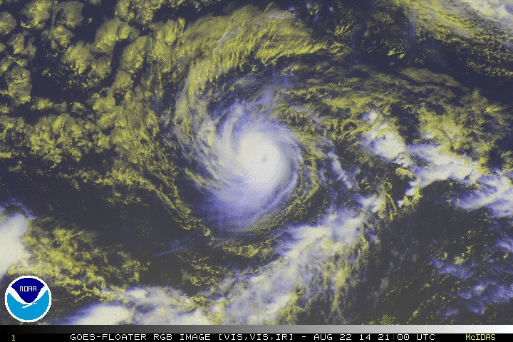
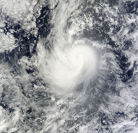
Karina becomes a hurricane a second time on August 22 at 2100 UTC
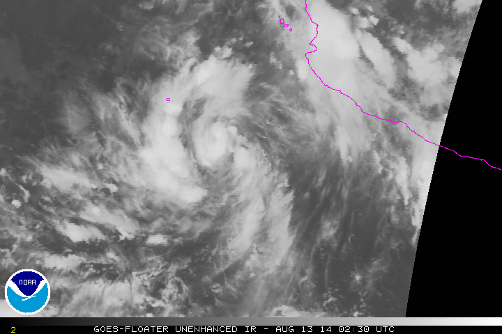
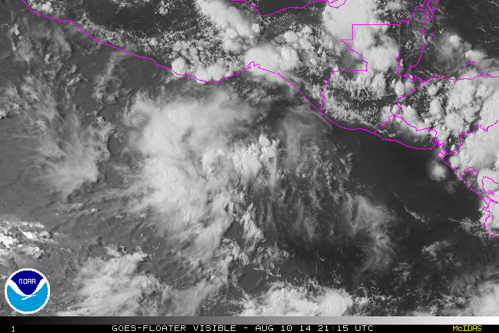
Tropical Depression Eleven-E forms August 13 at 0300 UTC
Personal Insight
Observations
Tropical Depression Eleven-E forms in the evening hours of August 12 and becomes a hurricane twice during its life-cycle
First of three storms
When I first looked at the satellite images of Tropical depression Eleven-E I sensed that she will be a calm one, out of harms way much like Hernan. Nothing else struck me about her life-cycle and the only other insight I received is that in this phase or cylce of events there will be three storms, namely Karina, Lowell and Marie before the next cycle begins. Karina becomes a storm on August 13, Lowell forms on August 18 and the thirteenth depression becomes a storm on August 22, namely Marie.
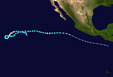
Because of her meandering back and forth path and becoming a hurricane twice during her life-cycle, I labelled her as Krazy Karina.
Tropical Depression Eleven-E formed on August 12. Twelve hours later it had intensified to a tropical storm and was named Karina while located 180 km south of Socorro Island. Tropical Storm Karina had moved due west, and later intensified to a hurricane on August 15 with winds of 75 mph (120 km/h). It then weakened to a tropical storm as it encountered unfavorable conditions, then later rapidly weakened to a low-end tropical storm on the next day. Thereafter, it steadily intensified to near hurricane strength, then had fluctuations in intensity while stalling before executing a loop and eventually re-intensifying to a hurricane on August 22 reaching a new peak intensity of 80 mph (130 km/h) on the next day. It then accelerated while turning northwest where interaction with Post-tropical cyclone Lowell and Hurricane Marie led to the increase of wind shear exposing the cyclone's low-level circulation center, causing it to weaken to a tropical depression on August 25. Karina continued to drift eastward for the next two days, before degenerating into a remnant low early on August 27. Later on August 27, the remnant low of Karina was absorbed by Marie, which was at tropical storm intensity.
According to the National Hurricane Center, Karina was the seventh longest lasting storm in the Pacific Ocean, east of 140º W.
August 14 at 1140 PDT(1840 UTC)
Karina becomes the sixth hurricane in the eastern North Pacific basin
National Aeronautics and Space Administration: Image by Terra/MODIS